Original Material
After the siege
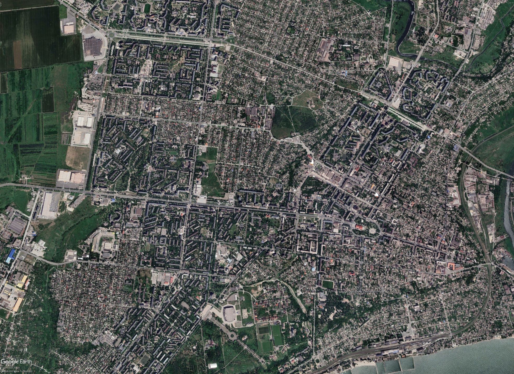
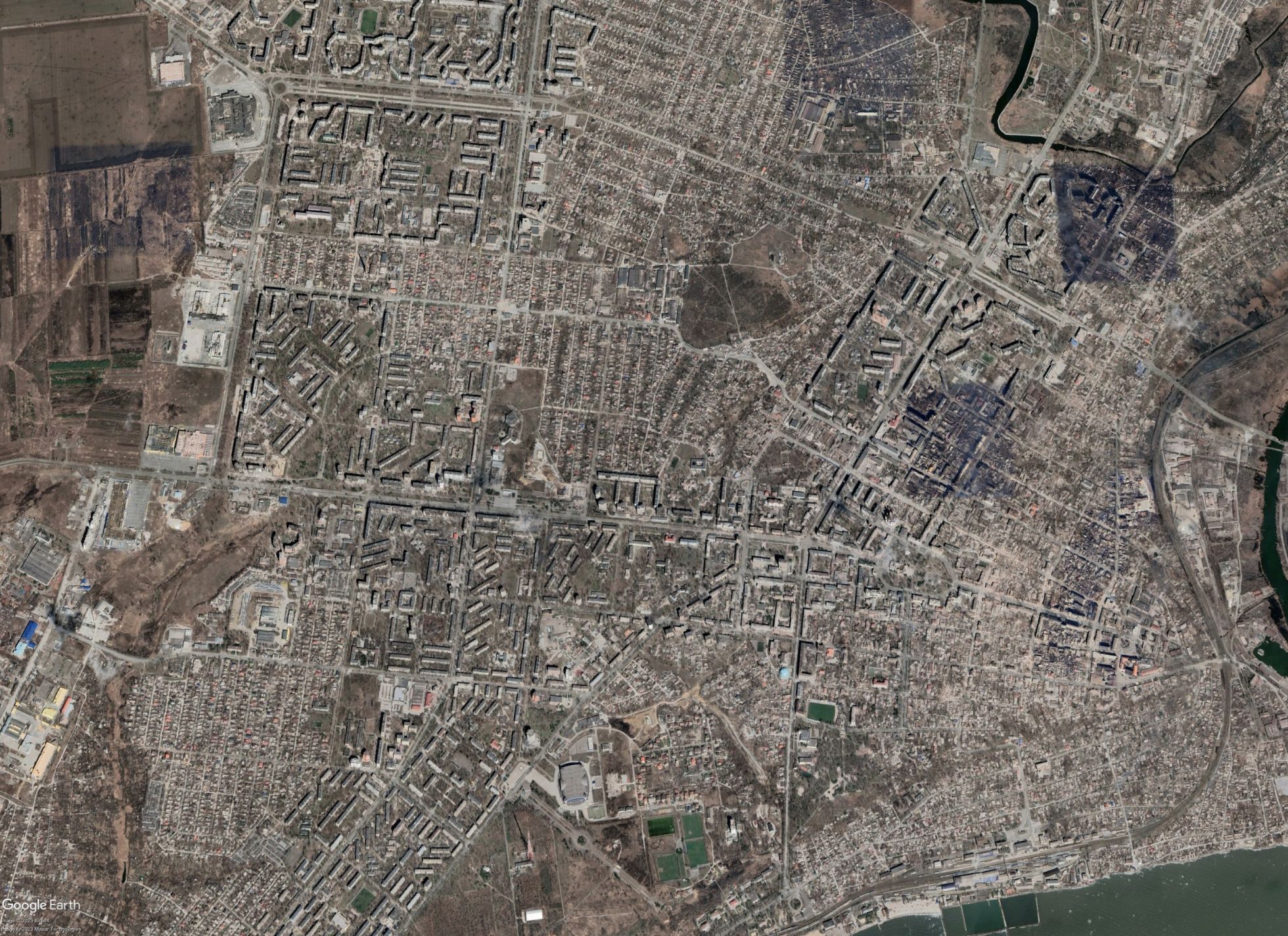
Google updated its satellite images of Mariupol for the first time since 2021. The photos show destruction on a catastrophic scale.
On April 25, Google Earth and Google Maps updated their satellite images of Mariupol. The previous satellite images were from June 2021, before Russia’s full-scale invasion of Ukraine. The new photographs were taken at different times following the start of the war, which is why fires are visible in some parts of the city, while in other areas occupying authorities are seen constructing new buildings. What’s more, one newly reconstructed area of Mariupol, which Vladimir Putin visited in March 2023, isn’t visible at all. The following photographs from Google Earth offer a glimpse at the extent of the destruction inflicted upon Mariupol since the start of the Russian invasion.
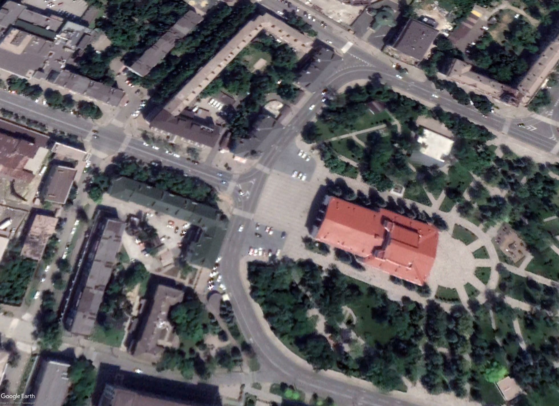
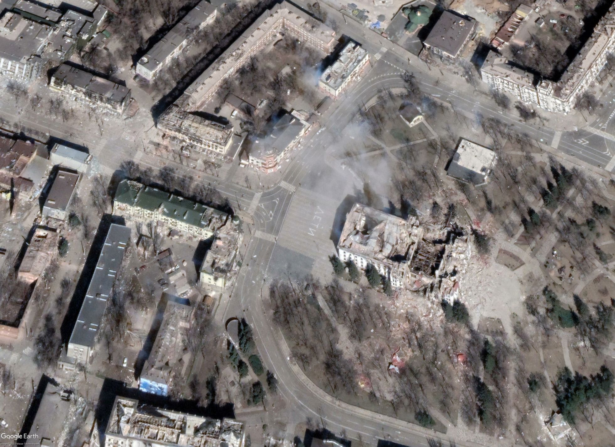
Mariupol’s city center
The Mariupol Drama Theater
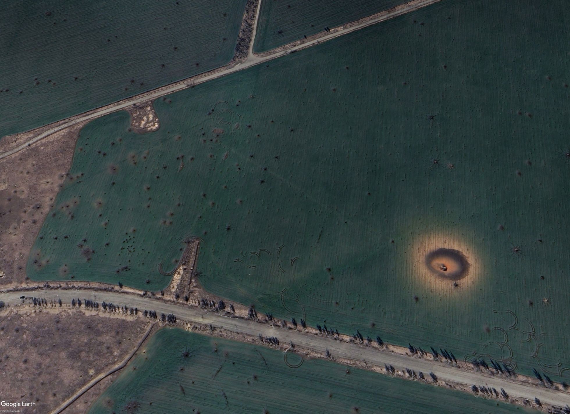
Craters from artillery fire in eastern Mariupol
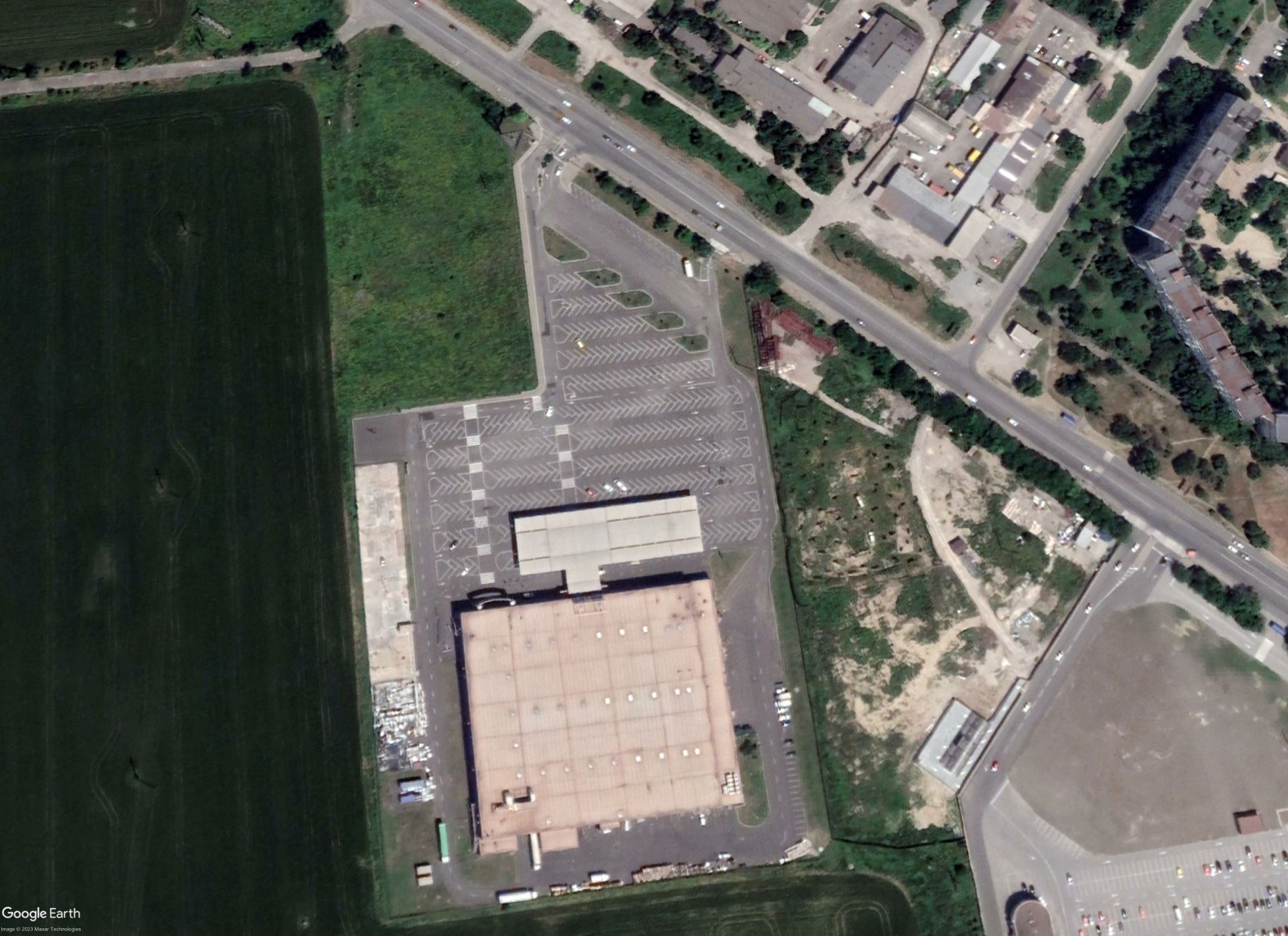
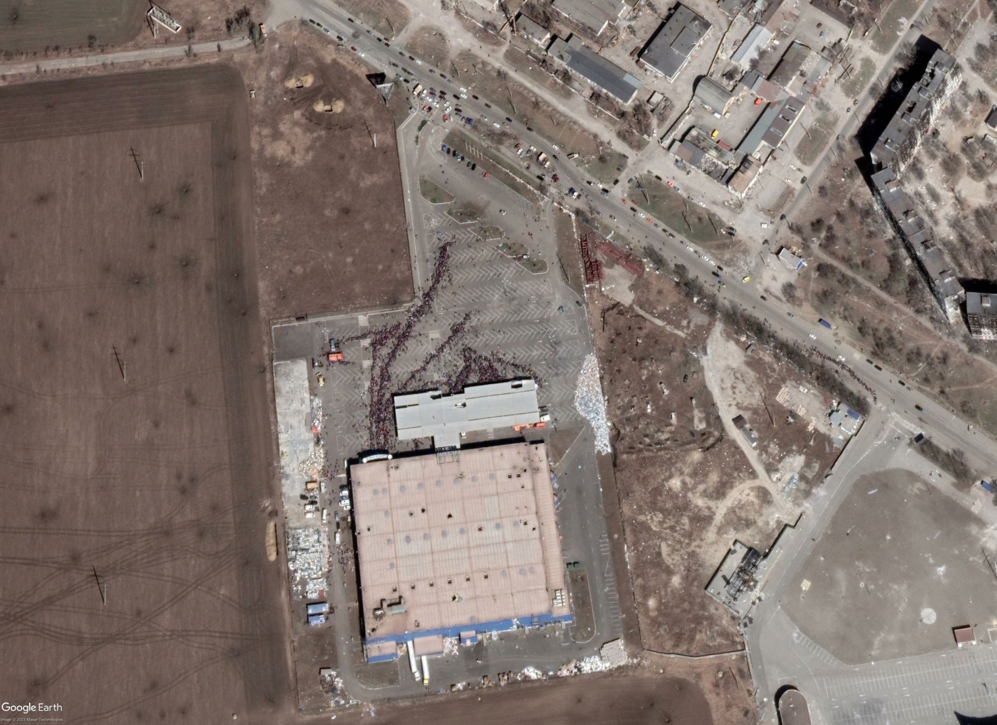
A line outside of a United Russia assistance center in Mariupol
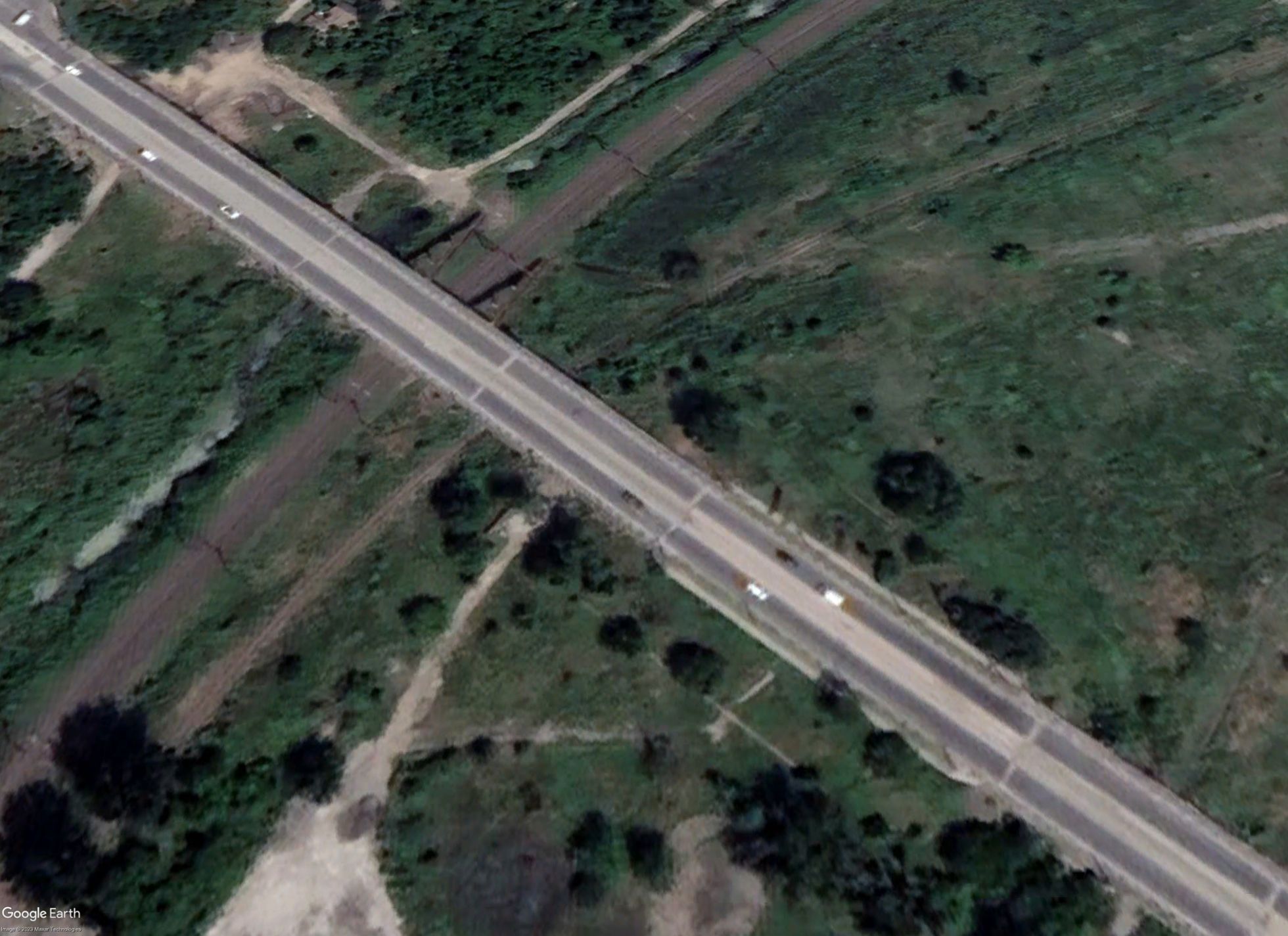
Checkpoint on the way to Azovstal Iron and Steel Works

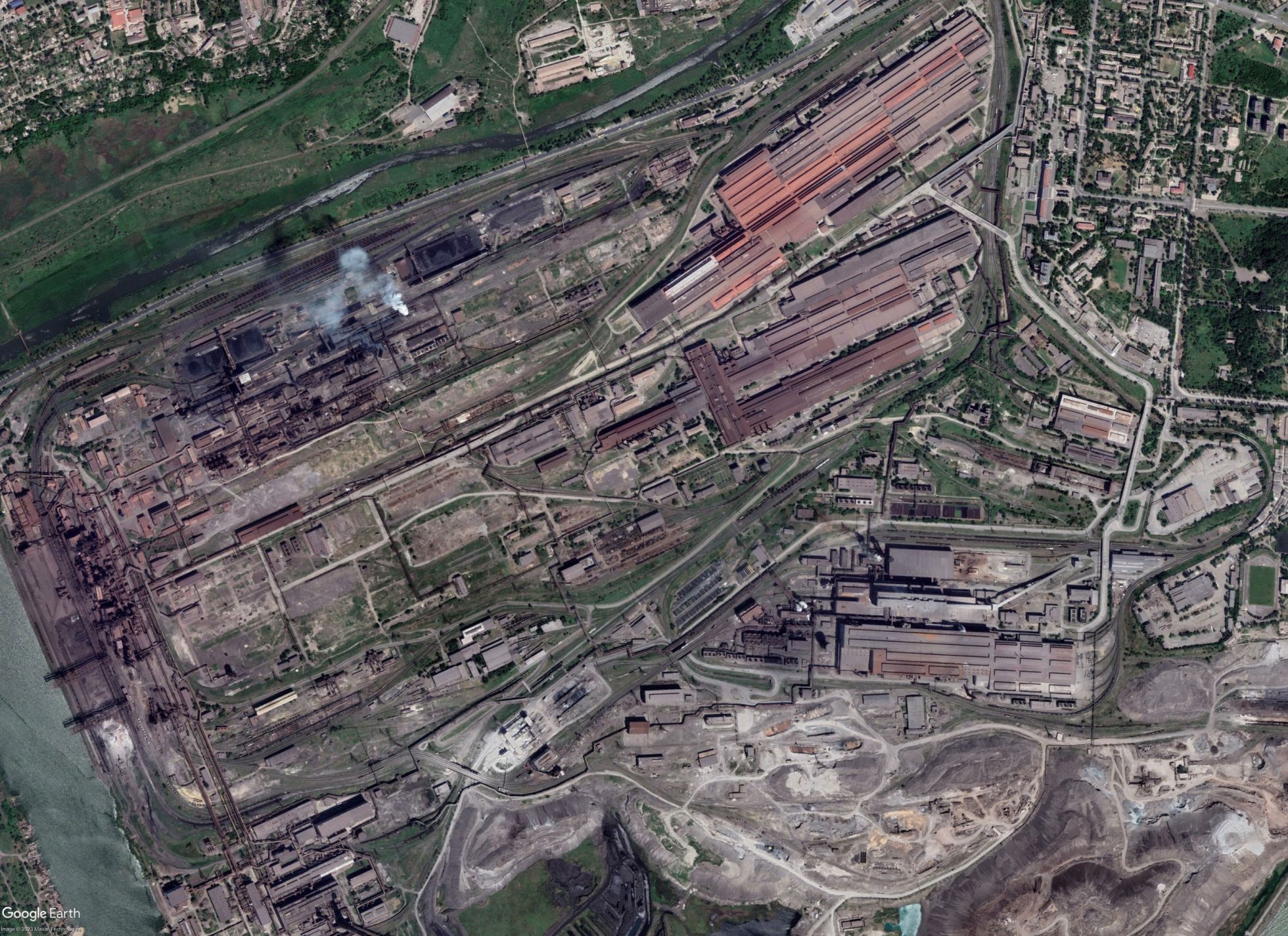
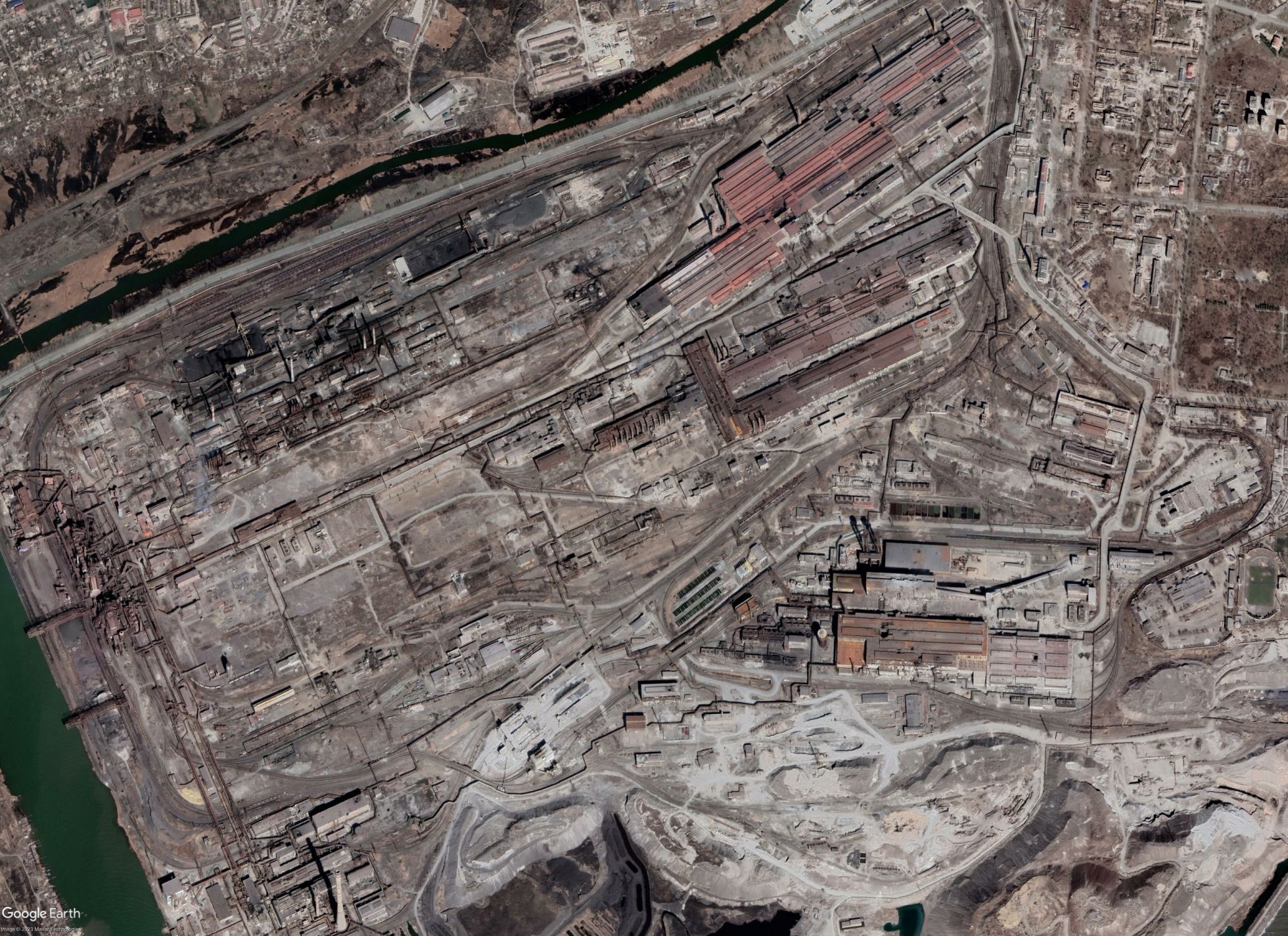
The Azovstal Iron and Steel Works
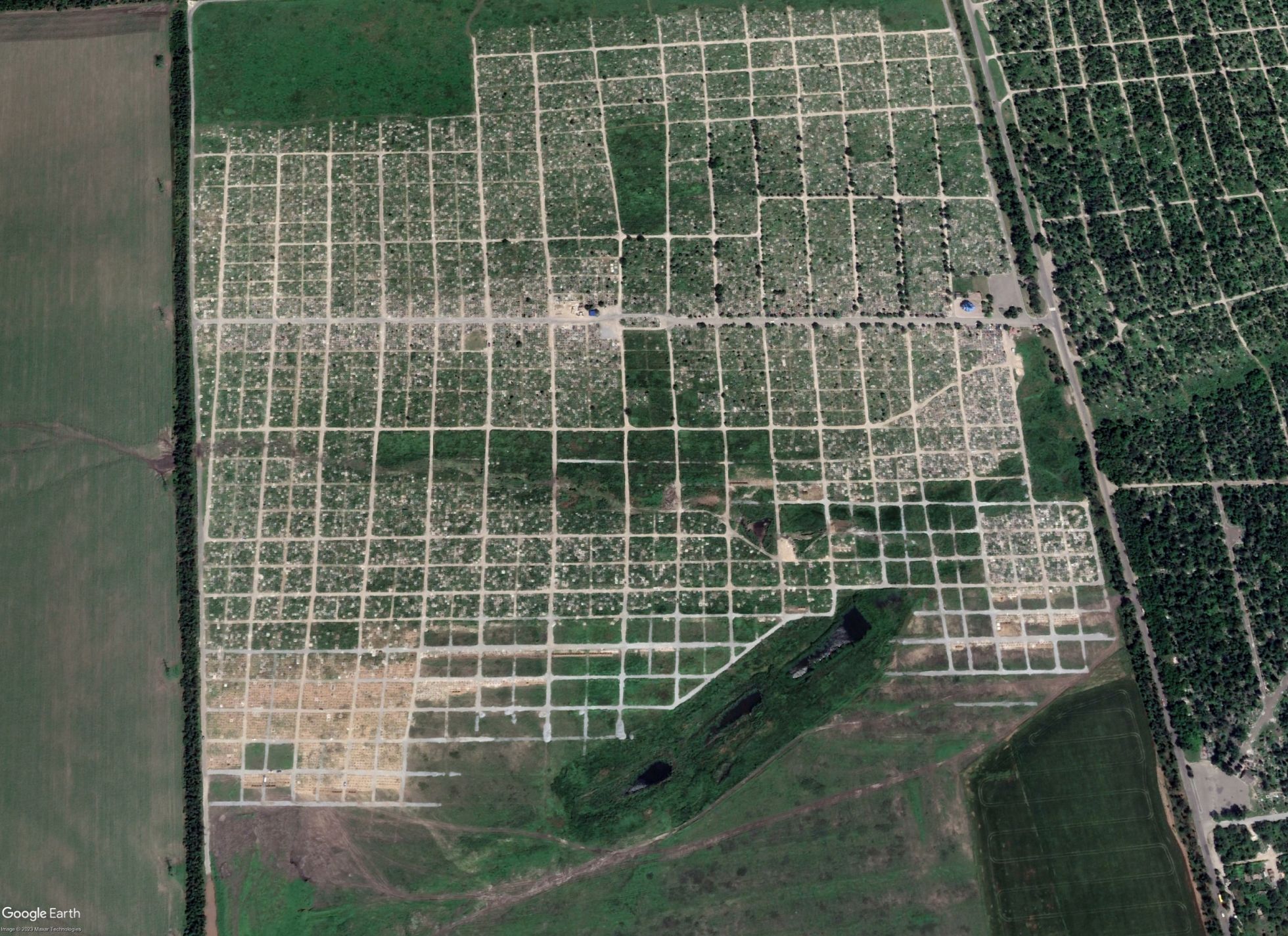
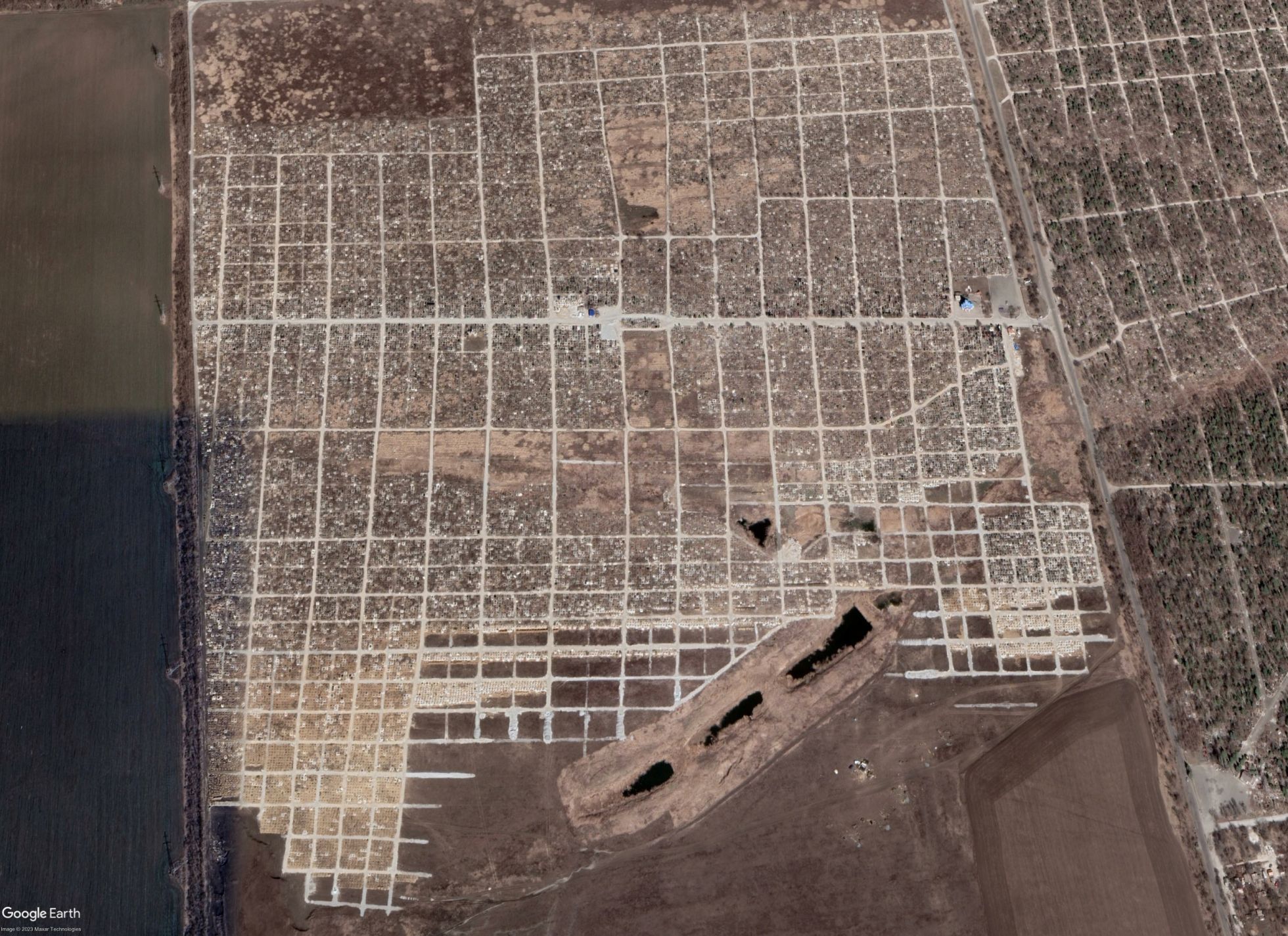
The Staryi Krym cemetery
Reportage by Meduza
Translation by Sasha Slobodov